

UK warns shipping: GPS jamming now a daily threat in key trade lanes
Britain’s Maritime and Coastguard Agency urges crews to train for satellite-free navigation.
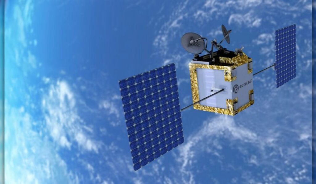
The UK’s Maritime and Coastguard Agency (MCA) has told shipowners that satellite navigation can no longer be relied upon in some of the world’s busiest shipping lanes, as GPS jamming and spoofing escalate into a daily operational hazard.
The warning, issued in Marine Guidance Note MGN 719, identifies the Baltic Sea, Black Sea, Middle East Gulf and parts of East Asia as high-risk zones where satellite-derived positioning, navigation and timing data are increasingly compromised. The MCA’s notice extends beyond electronic charts, listing vulnerable systems that include ECDIS, AIS, autopilots, dynamic positioning, radar, gyrocompasses and GMDSS communications equipment.
Onshore, the agency highlights exposure in vessel traffic services, pilotage systems, port management platforms and automated logistics networks. The financial stakes are stark: a seven-day GNSS outage could cost the British maritime economy £1.5bn ($2bn), with £1.3bn of that loss concentrated in port operations alone.
Brent Crude
The UK’s Maritime and Coastguard Agency (MCA) is the government body responsible for implementing maritime safety policy, regulating shipping standards, and coordinating search and rescue operations around the British coastline.
MGN 719 is the latest in a series of advisories addressing emerging threats to navigation.
Why GPS jamming is no longer a conflict-zone anomaly: gps jamming shipping
Maritime intelligence firm Windward’s latest figures reveal the scale of the problem. During the third quarter of 2023, an average of 5,131 GPS jamming incidents occurred daily, affecting more than 124,000 individual vessels.
In a single week in September, 1,702 impossible position jumps involving 379 vessels were detected in the Gulf of Oman. Four tankers in the Black Sea broadcast positions placing them in Lima, Peru, more than 12,000 km away from their actual location.
In East Asia, interference has affected vessels navigating through the South China Sea and the Strait of Malacca, two of the world’s most congested waterways. The spread of these disruptions beyond traditional conflict zones suggests that GPS jamming is now a systemic risk to global maritime operations.
Research published earlier this year by the Royal Institute of Navigation found that 14 percent of survey respondents had experienced an unsafe or unlawful situation resulting from GNSS interference. The findings suggest that satellite navigation disruption is now a routine operational risk rather than an occasional inconvenience confined to conflict zones.
What the UK’s guidance demands from shipowners
The MCA’s guidance urges operators to take immediate steps to mitigate the risks. Shipowners are instructed to identify all systems dependent on satellite-derived data, establish procedures for detecting interference, and regularly drill crews in alternative navigation methods. Recommended techniques include radar fixing, visual bearings, celestial navigation and dead reckoning.
A government questionnaire, believed to have originated in the UK, asked operators whether their crews had conducted GNSS-denial drills, understood the vulnerabilities of interconnected bridge equipment, and could operate ECDIS in dead-reckoning mode. The MCA’s latest notice echoes these concerns, emphasising that technological alternatives will take time to deploy.
For shipowners, the implications are clear: crews must be trained to navigate without satellite support, and bridge teams must be able to recognise the signs of jamming or spoofing. This includes monitoring for sudden jumps in vessel position, discrepancies between GPS and radar data, and unexplained failures in automated systems. The guidance also recommends that operators review their insurance policies, as some underwriters may require evidence of GNSS-resilience measures before covering vessels operating in high-risk areas.
Britain’s planned eLoran network, a terrestrial backup system, is not expected to provide an initial timing capability until 2028. Full positioning and navigation services are targeted for 2030, leaving the industry reliant on traditional methods in the interim. The delay underscores the urgency of the MCA’s call for immediate action, as the gap between current vulnerabilities and future solutions widens.
The escalation of GPS jamming poses a direct threat to the efficiency and safety of global supply chains. Approximately 90 percent of the world’s trade is carried by sea, and disruptions in key shipping lanes can have cascading effects on economies. A prolonged outage in the Baltic or Black Sea, for example, could delay shipments of grain, oil, and manufactured goods, leading to shortages and price spikes in European markets. Similarly, interference in the Middle East Gulf could disrupt the flow of crude oil and liquefied natural gas, affecting energy prices worldwide.
For port operators, the risks are equally significant. Automated container terminals rely on precise timing and positioning data to coordinate crane movements, vessel berthing, and cargo handling. A GNSS outage could bring these systems to a halt, causing delays and financial losses. The £1.3bn cost to British port operations projected in the event of a seven-day outage highlights the potential scale of disruption. Smaller ports, which may lack the resources to invest in backup systems, are particularly vulnerable.
Shipowners and charterers are also exposed to financial risks. Vessels forced to navigate without satellite support may experience delays, increased fuel consumption, and higher crew workloads. In extreme cases, spoofing incidents could lead to collisions, groundings, or unintended entries into restricted waters, resulting in costly legal disputes and reputational damage. The rise in jamming incidents has already prompted some insurers to review their coverage terms, with higher premiums likely for vessels operating in high-risk regions without adequate mitigation measures.
The MCA’s guidance places a strong emphasis on crew training and preparedness. Bridge teams must be proficient in traditional navigation techniques, which have largely been overshadowed by digital systems in recent decades. Radar fixing, for example, involves using radar returns to determine a vessel’s position relative to known landmarks or buoys. Visual bearings, meanwhile, rely on compass readings and sightings of fixed objects such as lighthouses or headlands. While these methods are less precise than GPS, they provide a critical fallback when satellite signals are compromised.
Celestial navigation, once a staple of maritime training, is also making a comeback. By measuring the angles between celestial bodies and the horizon, navigators can determine their position with reasonable accuracy. However, this method requires clear skies and a working sextant, which may not always be available. Dead reckoning, which involves calculating position based on speed, course, and time, is another essential skill, though it becomes less reliable over extended periods without external references.
To support crews, shipping companies are encouraged to conduct regular GNSS-denial drills. These exercises simulate satellite outages, forcing bridge teams to rely on alternative methods and identify gaps in their preparedness. The UK’s questionnaire to operators suggests that many crews are already being tested on their ability to operate ECDIS in dead-reckoning mode, where the system continues to estimate position based on last-known data and vessel movement. However, dead reckoning in ECDIS is only a temporary solution, as errors accumulate over time without GPS updates.
“Five thousand incidents a day is not a battlefield anomaly. It is a condition of the operating environment. And 124,000 vessels is not a subset of suspicious ships; it is a large share of the world’s merchant fleet.”
Windward·Maritime intelligence firm
While the MCA’s guidance focuses on immediate mitigation measures, the long-term solution lies in developing resilient alternatives to satellite navigation. Britain’s eLoran network is one such initiative, designed to provide a terrestrial backup for timing and positioning data. Unlike GPS, which relies on satellites, eLoran uses low-frequency radio signals transmitted from ground-based stations. These signals are more difficult to jam or spoof, making them a reliable fallback in high-risk areas.
However, the rollout of eLoran has faced delays. The system is not expected to provide an initial timing capability until 2028, with full positioning and navigation services targeted for 2030. The slow pace of deployment reflects the technical and financial challenges of establishing a nationwide network, as well as the need for international coordination. Other countries, including the United States and South Korea, are also exploring eLoran or similar technologies, but global adoption remains years away.
In the meantime, industry collaboration is essential to address the growing threat of GNSS interference. The MCA’s guidance is part of a broader effort to raise awareness and share best practices. The International Maritime Organization (IMO) has also issued circulars on the risks of satellite navigation disruption, urging member states to take action. Shipping associations, such as the International Chamber of Shipping (ICS) and BIMCO, are working with insurers and technology providers to develop standardised responses to jamming and spoofing incidents.
For shipowners, staying informed is critical. The MCA’s Marine Guidance Notes, IMO circulars, and reports from maritime intelligence firms like Windward provide valuable insights into emerging risks. Operators are also encouraged to monitor real-time alerts from organisations such as the International Maritime Bureau (IMB) and the NATO Shipping Centre, which track piracy, cyber threats, and navigation hazards in high-risk regions.
By combining traditional navigation skills with up-to-date intelligence, the maritime industry can navigate the challenges of a GNSS-denied environment, at least until more robust solutions are in place.
The MCA’s warning arrives as evidence mounts that satellite interference is becoming a permanent feature of maritime operations. With no immediate technological fix available, the onus falls on crews to adapt, before the next disruption leaves them navigating blind.


Sign up free to ask CAMAL AI for a summary, the key points or anything else about this story.
Related stories
CAMAL AI
 Financial Ports Newsletter
The maritime economy, every morning
Ports, shipping and freight markets in one short email. Free.