

NOAA picks Fugro for Florida seabed mapping as stock dips 1.8%
Dutch geo-data firm to survey 3,200 km² of Florida’s Atlantic waters under $3.5m NOAA contract
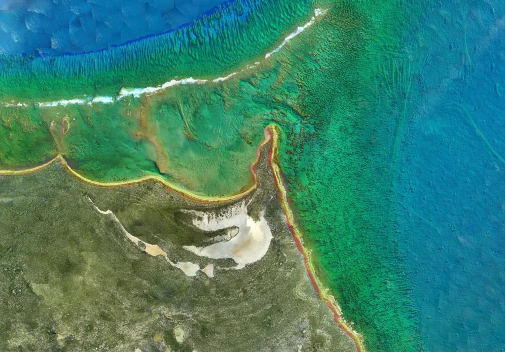
The National Oceanic and Atmospheric Administration (NOAA) has selected Dutch geo-data specialist Fugro to conduct hydrographic surveys across 3,200 square kilometres of Florida’s Atlantic waters, aiming to update nautical charts critical for maritime safety and economic stability. The project, announced on October 20, 2026, comes as severe storms and commercial expansions rapidly reshape the state’s coastlines, increasing the risk of hazardous groundings in shifting shallow inlets.
Fugro’s surveys will provide NOAA’s Office of Coast Survey with the precise bathymetric data needed to revise nautical charts that guide commercial shipping, government operations, recreational boating and other maritime activities. Accurate seafloor mapping is essential to prevent vessels from running aground in areas where sediment shifts and storm surges alter underwater topography.
The stakes: protecting trade and ecosystems
Florida’s maritime economy relies heavily on safe navigation through its coastal waters. NOAA’s continuous hydrographic updates are designed to mitigate risks such as groundings, which can disrupt supply chains, damage vessels and harm marine ecosystems. The agency’s data also supports environmental protection efforts by providing precise bathymetry for vulnerable habitats, including coral reefs and seagrass beds.
Fugro’s role in this project builds on its longstanding relationship with NOAA. The company recently completed hydrographic survey work along Florida’s Gulf Coast and has contributed to the Florida Seafloor Mapping Initiative, which has already mapped more than 56,000 square kilometres of the state’s waters. This latest contract reinforces Fugro’s position as a key provider of geo-data for maritime safety, infrastructure and environmental monitoring in the United States.
Fugro’s financials: mixed signals amid offshore wind pressures
The decline reflects broader challenges in the offshore wind sector, which has faced delays and cancellations due to rising costs and regulatory hurdles. Fugro’s revenue for the first half of 2026 reached €920.5 million, but the company reported a net loss of €62.1 million, underscoring the financial pressures in its core markets.
Despite these headwinds, Fugro has taken steps to strengthen its long-term strategy. On October 14, 2026, the company secured a €150 million unsecured facility from the European Investment Bank (EIB) to support the deployment of up to 25 new uncrewed surface vessels (USVs). The company also extended its existing senior debt facilities to December 2031, providing financial flexibility as it navigates market uncertainties.
Analysts cited weaker demand in offshore wind as a key factor, though the NOAA contract could provide a near-term boost to the company’s maritime division.
The updated nautical charts will be made available to mariners, port authorities and government agencies, ensuring that vessels can navigate safely through Florida’s dynamic coastal waters.
The project also aligns with broader efforts to map the world’s oceans. The Florida Seafloor Mapping Initiative, to which Fugro has contributed significantly, aims to create a comprehensive database of seabed data for the state. This initiative is part of a larger global push to improve maritime safety and environmental monitoring, with organisations like the International Hydrographic Organization (IHO) advocating for increased investment in hydrographic surveys.
For Fugro, the NOAA contract provides a critical reference point as the company seeks to diversify its revenue streams beyond offshore wind. The company’s next financial update is scheduled for October 30, 2026, when it will release its Q3 2026 trading figures. Full-year 2026 results are expected on March 4, 2027, offering further insight into Fugro’s financial health and strategic direction.
As climate change intensifies storm activity and coastal development accelerates, the demand for accurate seafloor data is likely to grow. Fugro’s work in Florida underscores the critical role of hydrographic surveys in safeguarding maritime trade, protecting ecosystems and supporting economic resilience in coastal regions.


Sign up free to ask CAMAL AI for a summary, the key points or anything else about this story.
Related stories
CAMAL AI
 Financial Ports Newsletter
The maritime economy, every morning
Ports, shipping and freight markets in one short email. Free.